Search This Blog

Sunday, November 23, 2014

Washington Valley Reservoir - Bridgewater Township, NJ


 Today, we took a nice hike around Washington Valley Reservoir.  Although the trees are bare, you will still be surrounded by Pine and Hemlock trees and an abundance of nature that is absolutely beautiful to hike through. We chose to follow along the reservoir today which was a treat for us and the pups!  There a few trails that pass by the body of water and some off trailing options that lead down to the water's edge.  Watch out for the mountain bikers, this park is one of the top places for mountain biking trails as well!

A must see in this area is the Hawk Watch area.  We didn't pass by here today but we've provided plenty of information about it below if you are interested.  The hawks do fly all over the park though; this is such an amazing sight to see in the sky above you.            

A Little Bit of History
Washington Valley Reservoir, formerly named Elizabethtown Reservoir, was damned in the 1920's for water supply to the Bound Brook area.  There is also a quarry in the area, Washington Mine (or Bound Brook Quarry), in which active mining continues to this day.  Before 1900, stone was carried out of the quarry to the railroad in Bound Brook by horse-drawn wagons.  The copper mines are now owned by Stavola Companies who are involved in asphalt and recycling materials, construction materials, contracting and real estate.

The Washington Valley Park Hawk Watch Area brings in hundreds hawk lovers.  In addition to hawks, falcons and eagles have been spotted in the sky above.  These birds journey south to far away places in Central and South America.  According to the Somerset County Park Commission website, Ospreys, Peregrine Falcons, and Bald Eagles are some of the most noteworthy of the birds soaring above the area.  


The Details
Trail Map:  http://www.somersetcountyparks.org/genInfo/maps/WashingtonValleyPk.pdf

Parking: Newman's Lane Parking Area.  See Google Maps Location below.

View Larger Map
 
The Hike 
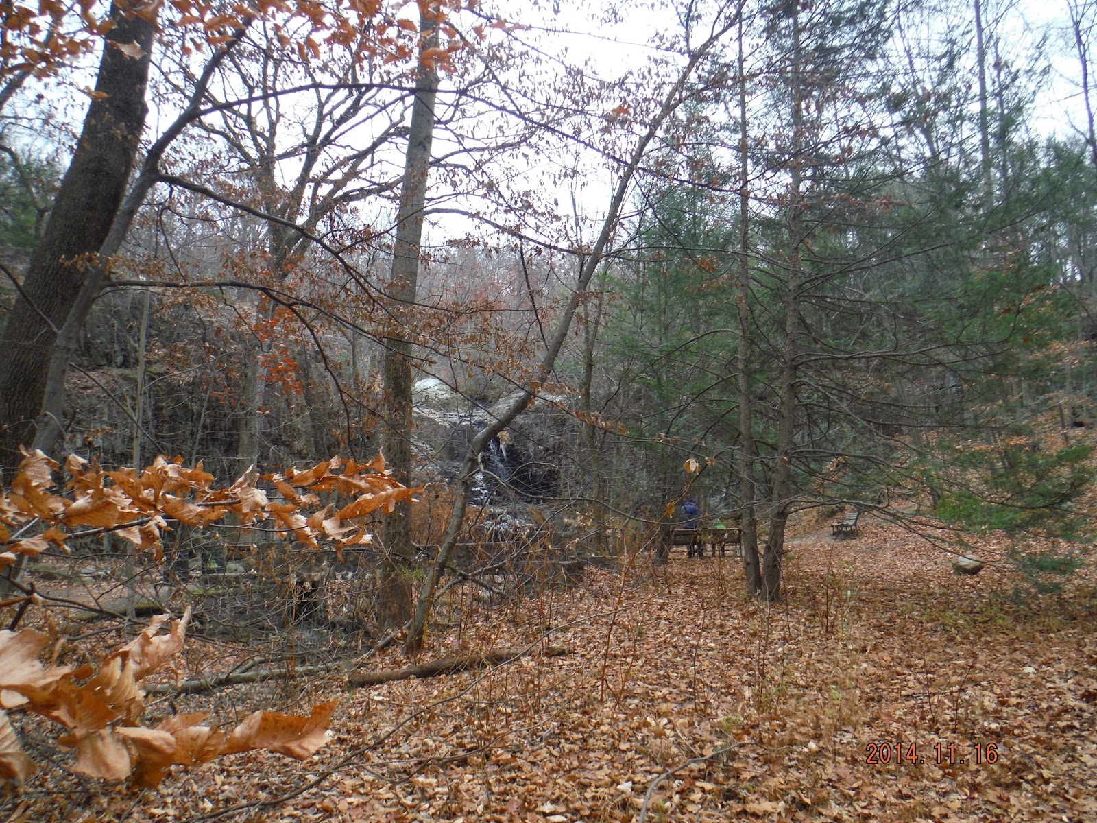
We followed the White Trail Perimeter along to the Middle Brook Trail, which leads your on a beautiful hike along side the Reservoir.  Head on to Chimney Rock Road but be very careful when walking on this road because it is a busy road.  There is a small section on the side of the road for hikers and bikers to safely walk.  There is small opening in the fence that leads you on to the Red Trail Perimeter trail which follows the Reservoir back to the parking lot.

The trek is easy to moderate (factoring in the Chimney Rock Road section and up a small hill in the beginning of the Red Trail Perimeter).  Most of the trails are cleared and easy to walk/bike on.  There are a few sections during the hike that lead you down to the reservoir, definitely check them out!

Our hike was 2.57 miles and took us a 1.5 hours to complete, stopping to view the water along the way. 

Check out our adventures below!

Parking Area
Beginning of White Trail Perimeter


Washington Valley Reservoir

These are spots heading off trail towards the water's edge.


Piper taking a dip!
Heading on to Chimney Rock Road

Gate that leads you back on to the Red Trail Perimeter

Partially frozen stream...

On our way home!


Monday, November 17, 2014

South Mountain Reservation – West Orange, Maplewood, Millburn, New Jersey


South Mountain Reservation is a beautiful hike in any season but in the Fall the trail is blanketed with all the colorful leaves that have fallen from the trees throughout the trek.  Your hike may only touch upon the 2,000 acres of vast nature, wildlife (mostly deer), trees, plants, creeks and falls but a must see is the Hemlock Falls area.  Although it was too cold yesterday, we usually head to the middle of the Falls (up the stone stairs) and make our way across to dip our feet in!  The pups love to jump across the waters and get their paws wet as well!   

A Little Bit of History
If you have a chance, another great spot to check out is the Washington Rock Lookout which, in the late 1770’s, during the Revolutionary war, was the location of Beacon Signal Station 9, one of 23 beacons built by General Washington to observe the movement of British troops quartered on Staten Island and Manhattan. Washington Rock served again as a lookout for the Army when reactivated during the War of 1812.  In the 1970’s, Samuel Campbell, was the first to dam the river to establish a paper mill.  Campbell’s Pond, located on the Rahway Trail (White) carries his name. 

The design of South Mountain was finalized by the Olmsted Brothers (the same brothers who designed Central Park) in stages over the years and a good deal of construction work was carried out by the Civilian Conservation Corps in the 1930s.  An interesting fact about the Olmsted Brothers is that, in addition to South Mountain Reservation, they designed 10 other parks/nature areas in New Jersey and several other locations throughout the tri-state area.  

The Details

For parking and the beginning of the trail, follow signs for the Dog Park.  Pass the Dog Park on left side and follow Bear Lane down a little until you reach a small parking area on your left hand side.    
See below for Google Maps location.


View Larger Map
 
The Hike 
This hike is a little difficult to follow in the beginning of our trail.  Unfortunately, the maps that are online are not so great for this trek.  We tried to take a picture of the colored map that is posted on the hike but you will see what happened below.  Right where you park there are two trees that have white ribbons tied around them.  According to the trail map this is called a "foot path".  You follow the foot path to the Lenape Trail (Yellow).  The Lenape Trail is much easier to follow along once you reach it!

The trek is moderate.  There are some some rocky sections and the steps at Hemlock Falls are pretty steep.  Other than that, many of the trails are paved and covered with leaves at this moment!

Our hike was 4.3 miles and took us a little of 2 hours to complete. 

Check out our adventures below!

                                               Parking Area on Bear Lane

                                              The entrance to the Foot Path
                                                     (white ribbon on tree)


                                             First traces on snow this season!!
                                  Coming down the mountain towards Hemlock Falls
                             
                              It was chilly but Piper still took a dip to fetch her stick!
                                                            Hemlock Falls

                                      Up the stone stairs following the waterfall up
                                                       Great views at the top!
Playing around!


We were going to take a picture of the colored map but unfortunately someone cut it out...such a shame.  I hope it is replaced soon...


Heading back to the car!


Sunday, November 9, 2014

Watchung Reservation, (Summit, Mountainside, Berkeley Heights, Scotch Plains, and Springfield) NJ


Watchung Reservation is one of our favorite hikes. We have hiked here in all four seasons and have explored quite a bit throughout this park. It is definitely a beautiful hike filled with an abundance of history, trees, flowers, streams and lakes. The pups get their full days worth of sniffing, exploring, swimming (weather permitted) while we humans feel the tranquility much needed from our busy lives!! 

There are seven different trails and plenty of unmarked trails to explore the day away. See links to the trail map, Google map location and EveryTrail map below. 

A little Bit of History 
The best part of starting this blog was the fact that we not only get to share our hikes with you and provide information for you to explore the hidden gems of this area, but the decision to do some research about the history of each location we choose for our hikes. 

For instance, we found out that Watchung Reservation was designed by the Olmsted Brothers of Brookline, Mass., the celebrated landscape architects who designed New York’s Central Park and scores of other notable public lands. The Trailside Nature & Science Center is the oldest surviving trailside museum in the United States and that 1882, in the middle of the Reservation, Warren Ackerman bought the property (Deserted Village of Feltville/Glenside Park site) and converted a mill town into a summer resort, called Glenside Park. 

Don’t miss out on the other history points through your hike, including: 
 • Feltville Mill Site – Named after David Felt, who built the mill in 1845 serve as a factory for his printing business. He then built an entire town, Feltville, on the bluff overlooking the mill to house his workers. The Mill was torn down in the 1930’s but there are ten surviving historic buildings, some of which are still inhabited that you can pass during your hike. 
Copper Mine – Copper exploration dated back to the 1600’s. 
Hermit’s Pond – Named after a man who was responsible for operating a steam-driven pump and steam laundry at the pond back in the 1800’s. 
Seeley’s Pond – Named after Edmund A. Seeley who founded a paper manufacturing company and used the falls for power in the late 1800’s. The waters flow over the dam in Seeley’s Pond and flow into the Green Brook headed into the Raritan River. 
Lake Surprise – This Lake has had several names dating back to the 1840’s. From Feltville Lake to Ackerman Lake then Silver Lake and now due to the park planners laying out a road to the lake that wound its way down through the woods such that the lake could not be seen, it is now called Lake Surprise. In its time, this lake was popular for swimming and boating but is now seen as a popular site for fishing and admiring its beauty as you walk around the trail surrounding it.

The Details

Our hike began at the Sky Top Picnic Area. There is parking on both sides of the street. See below for Google Maps location.


View Larger Map


The Hike 
We followed the Sierra Trail - white trail (starting to the left of the covered pavilion) into the Reservation and the History Trail-pink trail back out.  Our hike was about a 4 miles and took us about 2 hours to complete stopping often for breaks for the pups to swim and for us all to explore.  We consider this trail fairly easy; no major hikes in elevation and the walking surface is mostly small rocks and some pavement.
Check out our adventures below!


                                                          Sky Top Pavilion


                                                    Having fun in the stream!


                                                            Masker's Barn
                                                 Deserted Village of Feltville

                                             We believe someone lives here!
                                              Church/Store - bathrooms in rear.
                                             A great place to take a water break


                                          Cemetery of Willcocks and Badgley

                                                        Colbie's favorite log!


                                                  Friends made along our hike!


     Piper thought about it but decided against it seeing the green film on top of Hermit's Pond.
                                                     Heading back to the car :)