Search This Blog

Thursday, December 25, 2014

Norvin Green State Forest - Wanaque, New Jersey


Norvin Green State Forest is definitely a new found gem of ours in New Jersey.  We explored a small section of this untouched 5,000 acre forest providing a beautiful home to birds and other wildlife.  The uphill rocky trek on the High Point trail is well worth every gasp of air you take making your way up.  Once you reach the top, you'll find amazing views including the New York Skyline and the Wanaque Reservoir.  Since it was a cloudy day, we were unable to get clear photographs of the Skyline, but we were able to catch a glimpse in the distance.  This is definitely a place to consider when looking for a challenging, yet rewarding hike in New Jersey.

A Little Bit of History
It's a shame that we cannot find much written history of this area.  According to the New York New Jersey Trail Conference, Norvin Hewitt Green, nephew of Ringwood Manor owner Abram S. Hewitt, donated much of this land to the State of New Jersey in 1946.   Visit USA goes on to explain that it is part of the Wyanokie Wilderness Area and is home to an extensive trail system built from old logging roads.  Several trails link up with public and private facilities including the Weis Ecology Center and the Wanaque reservoir property.  The existing trails are either old forest roads or new trails constructed by volunteers.

The Highlands Natural Pool and Weis Ecology Center
We were, however, able to find some history about the Highlands Natural Pool that you'll pass along the trek.  The Highlands Pool is located in the Wyanokie Highlands adjacent to the Norvin Green State Forest. In 1921 Camp Midvale was founded as a haven for working people seeking refuge, recreation, community, and nature by a group of outdoor enthusiasts called the Nature Friends. In 1935, Nature Friends volunteers carved the present pool out of the hillside by hand.  In 1974, Walter and May Weis provided an endowment in order to realize their dream of preserving land for the purpose of environmental education.  Thus the former Camp Midvale property became the Weis EcologyCenter (WEC), a private, non-profit organization created to offer the public a unique opportunity to learn about the Northern New Jersey Highlands Region.  The WEC later became one of New Jersey Audubon Society's centers. WEC closed the pool in 1994. In 1995, New Jersey Audubon agreed to allow the community to open the pool and in 1996 The Community Association of the Highlands incorporated, reopening the site as the Highlands Pool. In 1998, NJAS/WEC formally donated the pool to the community.  In 2012 NJ Audubon Society closed the WEC. The fate of the buildings and surrounding structures are unknown as of 2014. The Highlands Natural Pool remains open and run by the community.

The Details
Trail MapPDF Map of Norvin State Forest Trails

Parking: See Google Maps Location below.
N41 04.192 W74 19.303


The Hike 

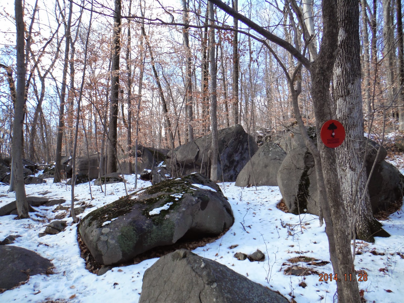
The trek is moderate to difficult (factoring in the rockiness and uphill climbs during the trail).  
   
Our hike was 4.09 miles and took us a 3.19 hours to complete; stopping several times for water breaks and pictures.   We had fun with this hike and didn't follow one specific trail.  The trail markers are very visible on the trees and the map is pretty easy to follow.  Don't forget to bring your map! 

 Check out our adventures below!

Walking down the street to the beginning of the trail...

Entrance to Highlands Natural Pool


Breathtaking views


All worn out!!


Monday, December 1, 2014

Sourland Mountain Preserve - Hillsborough, New Jersey

Sourland Mountain Preserve is a hidden gem in Somerset County and a favorite hike of ours.  We usually begin our hikes pretty early in the morning so a majority of the time we have this entire 4,000 acre preserve to ourselves.  This weekend, there were a few others, (families mostly) who shared the trails with us.  Due to the recent snow storm in New Jersey, the trails were filled with a light coating of snow and bit more muddier than usual.  The pups of course loved the trails as they were happy to be prancing in the snow and getting nice and dirty in the mud!  This trail, due to it being filled with sedimentary and igneous rocks of late Triassic and Early Jurassic age, is very rocky and the boulder areas are incredible to see. 

A Little Bit of History
Sourland Mountain spans 7 miles in central New Jersey, extending from the Delaware River at Lambertville to the western end of Hillsborough Township (which is where our hike took place) near the community of Neshanic, through Montgomery Township and into Hopewell Township in Mercer County.  There are several different theories as to how "Sourland" receive it's name, one of them being, “sorrel-land” which describes the sorrel (reddish-brown) colored soils encountered by the pioneering German farmers. 

Sourland Mountain supported a thriving peach farming industry.  But a blight just before the start of the 20th century, as wells as a statewide shift to an industrial economy, eventually crippled agriculture on the mountain.  New forests began to grow over abandoned farmland. The only pre-20th century industry that was able to survive into the modern era was rock quarrying –the mountain’s trap rock was crushed and used to build railroad beds and roads throughout the region.

For the first half of the 20th century, Sourland Mountain remained a remote part of New Jersey, with few connections to nearby metropolitan areas.  This changed in the 1940s when new road construction made the mountain more accessible, allowing suburbia to begin invading its valleys and slopes.  Today the mountain acts as a watershed for surrounding communities, while at the same time providing recreational opportunities to Central New Jersey.


The Details
*The map on the Somerset County Parks is an older version, before the red trail-Roaring Brook Trail was put on the map.  I was able to locate the updated version on Wikipedia.  You can also grab a trail map at the beginning of the trail.  
Trail Map: http://en.wikipedia.org/wiki/Sourland_Mountain_Preserve#mediaviewer/File:Sourland_Mountain_Preserve.jpg
Old Map:
http://www.somersetcountyparks.org/maps/SourlandsMap.pdf

Parking421 East Mountain Road, Hillsborough, NJ   08844.  See Google Maps Location below.


 The Hike 
We began our hike from the parking lot on E. Mountain Road in Hillsborough.  We followed the Ridge Trail (white trail - dashes) for most of our hike.  When we hit the Devil's Half Acre Boulder area, we jumped onto the Red Trail - Roaring Brook Trail.  When we reached the Roaring Rocks Boulders we headed back on to the Ridge Trail (white trail - dashes) (at location 7 to 6 to 5 on the map).  From here we followed the Texas Eastern Pipeline Trail back to the parking lot, passing a small pond right before you reach the lot. 

The trek is moderate (factoring in the rockiness and uphill climbs during the trail).  There were several remnants of ice patches on the bridges but this was due to the snow storm.  
  
Our hike was 5.09 miles and took us a 2.5 hours to complete, stopping several times for water breaks and pictures. 

Check out our adventures below!

Parking on E.  Mountain Rd.


Beginning the Ridge Trail 


Having fun on the boulders! 


Checking out some of views


Heading on to the Red Trail


 Texas Eastern Pipeline Trail


Heading back to the parking lot.  

Pond in front of parking lot


Sunday, November 23, 2014

Washington Valley Reservoir - Bridgewater Township, NJ


 Today, we took a nice hike around Washington Valley Reservoir.  Although the trees are bare, you will still be surrounded by Pine and Hemlock trees and an abundance of nature that is absolutely beautiful to hike through. We chose to follow along the reservoir today which was a treat for us and the pups!  There a few trails that pass by the body of water and some off trailing options that lead down to the water's edge.  Watch out for the mountain bikers, this park is one of the top places for mountain biking trails as well!

A must see in this area is the Hawk Watch area.  We didn't pass by here today but we've provided plenty of information about it below if you are interested.  The hawks do fly all over the park though; this is such an amazing sight to see in the sky above you.            

A Little Bit of History
Washington Valley Reservoir, formerly named Elizabethtown Reservoir, was damned in the 1920's for water supply to the Bound Brook area.  There is also a quarry in the area, Washington Mine (or Bound Brook Quarry), in which active mining continues to this day.  Before 1900, stone was carried out of the quarry to the railroad in Bound Brook by horse-drawn wagons.  The copper mines are now owned by Stavola Companies who are involved in asphalt and recycling materials, construction materials, contracting and real estate.

The Washington Valley Park Hawk Watch Area brings in hundreds hawk lovers.  In addition to hawks, falcons and eagles have been spotted in the sky above.  These birds journey south to far away places in Central and South America.  According to the Somerset County Park Commission website, Ospreys, Peregrine Falcons, and Bald Eagles are some of the most noteworthy of the birds soaring above the area.  


The Details
Trail Map:  http://www.somersetcountyparks.org/genInfo/maps/WashingtonValleyPk.pdf

Parking: Newman's Lane Parking Area.  See Google Maps Location below.

View Larger Map
 
The Hike 
We followed the White Trail Perimeter along to the Middle Brook Trail, which leads your on a beautiful hike along side the Reservoir.  Head on to Chimney Rock Road but be very careful when walking on this road because it is a busy road.  There is a small section on the side of the road for hikers and bikers to safely walk.  There is small opening in the fence that leads you on to the Red Trail Perimeter trail which follows the Reservoir back to the parking lot.

The trek is easy to moderate (factoring in the Chimney Rock Road section and up a small hill in the beginning of the Red Trail Perimeter).  Most of the trails are cleared and easy to walk/bike on.  There are a few sections during the hike that lead you down to the reservoir, definitely check them out!

Our hike was 2.57 miles and took us a 1.5 hours to complete, stopping to view the water along the way. 

Check out our adventures below!

Parking Area
Beginning of White Trail Perimeter


Washington Valley Reservoir

These are spots heading off trail towards the water's edge.


Piper taking a dip!
Heading on to Chimney Rock Road

Gate that leads you back on to the Red Trail Perimeter

Partially frozen stream...

On our way home!